An Outstanding Day in the Wilds of Corsica
As per normal, we arose a little before first light to get an early start, but this time with a heightened sense of excitement. We'd set ourselves the goal of getting all the way to the Village de Bavella and were pretty psyched as the weather was looking really good.
All up the task we'd set ourselves looked like this:
- Distance: 28 km
- Total ascent: 1390 m
- Total descent: 1920 m
- Time: 12 hours
Those are pretty big number for a couple of old codgers so we wanted to get away early. As we were rising and heading out the door Thomas of the Irish Trio, with whom we'd caught back up on day nine, wished us good luck from his bunk - to the displeasure of a few folks who'd stayed up late the night before.
We had a quick breakfast along with a few other early starters then set off. Here's a snapshot of the section of map that covers the terrain, with our route delineated in black and red (coincidentally
my team's colours!) It's probably worth pointing out at this stage that Paddy Dillon's Cicerone guidebook describes the GR20 as travelling the way I have marked it, along the original route. Apparently the new "official" route, and the one preferred by most guidebook authors and GR20 commentators traverses valleys to the west and goes via Refuge Matalza. This became the standard route after the Refuge d' I Pedinieddi was destroyed by lightning, over concerns about the length of the stage from Usciolu to Asinau, and the fact that it went up and over the exposed peak of Monte Incudine. Anyway, here's our route ...
 |
| Refuge d'Usciolu to Village of Bavella |
It was just light enough to see without our headlamps when we set off up a short, steep climb to the crest of the ridge that runs southwest for quite a way ~ perhaps four kilometres or more. Just about as soon as we hit the crest we could make out the coast to the east, with the ranges in between still in shadow when I took this photo at 6:49 a.m. ...
 |
| Looking east towards the coast |
In another quarter of an hour the sun was bathing the granite outcrops of the ridge in a beautiful golden colour. In the photo below, taken at 7:07 a.m., the route will take us above and right of Di, who you can make out just about exactly in the middle of the photo ...
 |
| Rambling through low shrubbery and over granite slabs |
The start of the day's walk was sublime - just the sort of morning you dream about as a hiker. Clear and windless, with gentle ups and downs along a wide, gently ascending ridge. And it was warm - you might have noticed in the previous photo that Di is back in shorts and a t-shirt again.
We were constantly looking ahead, trying to pick which way the trail would take us: would it be around that next bump on the left, right or straight over the top? Sometimes we were right; sometimes not. In the next photo we are on the crest itself, and down to the left in the valley you can make out a couple of small villages. The track is just visible on the left edge of the photo ...
 |
| Tracing the edge of sunshine |
In the next photo you will notice that Di has her poles in hand. We thought the trail was leading us around to the west - or right - of the next rocky bump on the ridge. It started that way but then ducked up through a little gap that you might be able to make out just around to the right ...
 |
| Di picking her way through the boulders |
Out the other side we emerged and then there was some gorgeous sidling in early morning sunshine ...
 |
| Sidling along just below the crest of the ridge |
It was now just about an hour after leaving the refuge. Di paused while I snuck ahead to get a view looking back along the ridge ...
 |
| Glorious early morning walking |
Almost before we knew it we had traversed the ridge, dropped down and found ourselves winding through these strange stumpy beech trees ...
 |
| A small plateau with short, thick beech trees |
The track led us around to a small, open plateau. Just on an hour and a half after starting our walk for the day we were in what seemed almost like a totally different environment and an idyllic spot for a little cabin and a few sheep ...
 |
| Just strolling along ... |
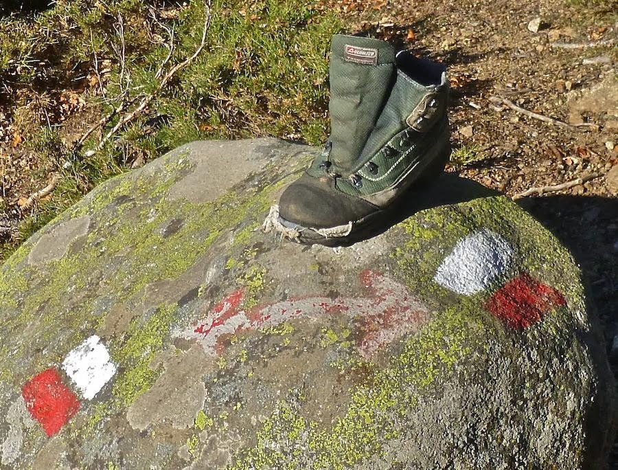
From this gorgeous little plateau the track dropped down an open hillside where we came across a relic from some previous passerby helping to mark the way ...
 |
| Boot Camp? |
By now it was just after 8:30 and the sun had climbed higher into the sky and the track led gently down through maquis vegetation to a shallow valley. Ahead you can see the slopes of Monte Incudine which, at 2134 metres will be our high point for the day ...
 |
| Descending from the Plateau du Cuscione |
It was lovely wending our way down through this gradually sloping valley but we did have to be careful to stay on the track as the maquis on either side was very close to the track in places, up to mid-thigh in height and very prickly! At the bottom of the valley we crossed a small creek that ran along the edge of the forested slopes leading upwards ...
 |
| At the bottom of the valley |
By this time we had been on the go for about two and a half hours so we decided to pause for a little snack in the sunshine just above the tree on the other side of the stream before starting the gradual ascent of Monte Incudine.
We were a bit surprised to surmount the hill and find we had another small vale to cross before we actually started the climb, but shouldn't have been as we did know that there was the site of an old refuge - which had been destroyed by lightning strike - to pass before we started climbing properly. (Incidentally, this is the one spot where wild camping is actually permitted along the GR20.) Another small stream wended its way through this vale providing moisture for small patches of flowering herbs ...
As we began our climb up out of the valley I paused to take this photo looking back the way we'd come, where the open rocky ridge line, forest and clear slopes had provided a great variety of walking for the first half of the morning's walk ...
 |
| Wonderful varied walking |
It might now be worthwhile to provide a bit of map detail to illustrate the landscape and home in on our whereabouts at this point of the day's walk (look for the yellow circle near the centre of the map) ...
 |
| Mid-morning Day 11 |
I'm not sure but I think the next photo is looking up towards the Crête de la Foce Aperta, which we will eventually join towards its upper end ...
 |
| Back up into the alpine region |
... and now we are nearing the summit of Monte Incudine ...
 |
| The summit of Monte Incudine beckons |
This is actually the same photo sliced thinly for a more delicate flavour ...
 |
| Having your cake and eating it too ... |
We paused for the obligatory summit photo, knowing that we'd knocked over most of the ascending required for the day. (I was reluctant to include this photo as it is all too revealing about how much I'd been indulging in the filthy joys of
Kouign Amann while in belle Bretagne, and the general slothfulness associated with our tour to
FNQ. Time to start getting fit again ...
 |
| Padded Grandpa and Beaming Grannie |
Between us and the east coast were some rugged little ranges, slightly obscured by mist ...
... which blew away as we sidled around towards the descent off the peak. The next photo was taken just above the start of a long slabby traverse that went farther left than we imagined it needed to, but again this can be seen in the map detail above. We had thought that the beauty of the GR20 might abate somewhat as we hiked further south but we were delighted to find it continued to maintain its quality through this day and indeed, as the next post will show, right to the very end.
It's just 600 metres down to Refuge d'Asinau but this happens pretty quickly as it is one of the steeper descents on the route. We paused at the refuge where the guardian was rather too preoccupied entertaining friends on his back verandah to pay much attention to hikers! It would have been good to enjoy a cool drink, but thankfully we'd acquired the necessaries at Usciolu to put together lunch, which we enjoyed on the front verandah.
After about forty minutes break we shouldered our packs and set off for the second stage of the day. This view back just after we set out again shows the position of Refuge d'Asinau up on the hillside just above the tree line ...
 |
| Refuge d'Asinau |
There are two routes for the next stage through to the Col de Bavella and the village just down the other side. The main route of the GR20 is meant to take 4 3/4 hours and have 380 metres of ascent and 695 metres of descent. The high level route - which I was attracted to - is actually half an hour quicker but has an additional 170 metres of ascent and descent. However Di had been adamant that if we were to run stages 13 and 14 together she'd only do it if we took the longer but easier low-level route. Probably a good idea because both of us had knees that were feeling a little creaky after the steep descent off Monte Incudine. (If we ever go back to do some more hiking in Corsica we'll have to make a point of getting up on the crest of the
Aigulles de Bavella and the Punta di u Pargulu as the views are meant to be stunning.)
After a short traverse and then a descent of 100 metres the track traverses for about three kilometres through lovely laricio pine forest like this ...
 |
| Pine forest between Ascinau and Bavella |
... before descending another 400 metres or so. Then, after traversing around the toe of the Crête du Pargulu, a long sidle is made into a deep re-entrant to get around the Ruissseau de Caracatu. The views were quite limited at this stage but eventually after traversing some wonderful forest, things started to open out again and the road leading up to Col de Bavella came into view across the way, along with peaks that we would walk through the next day ...
 |
| The road to Col de Bavella can be seen on the slopes opposite |
Paradoxically we descended a little more when we thought we'd really like to start climbing up towards the col ...
By this time the Aiguilles de Bavella had started to dominate the landscape ...
 |
| Aiguilles de Bavella |
It dawned on us that we still had some way to go and Di was starting to slow up a bit so she sat down for a little rest ...
 |
| How much farther, Dad? |
Eventually we got around the toe of the ridge and found ourselves ascending through some more lovely forest towards the Col de Bavella where we came across evidence of the island's rich history of animal husbandry in the mountains in the form of a stone wall ...
 |
| Nearing the Col de Bavella |
Have you missed my digressions in the last few posts? Well, in honour of the extraordinary beauty of Col de Bavella it's time I returned to my normal habit of rambling off ...
... before we'd left Tasmania for our trip to Corsica for the GR20 our friends Alan and Penney had returned from there and the Land Of The Pom. While in the latter Alan obtained a copy of "
Edward Lear in Corsica: Journal of a Landscape Painter" (published in this edition in 1966; Price 50s net - much dearer now, no doubt!) and generously lent it to me. It was a terrific opportunity to get a sense of Corsica in 1851 when Lear was there as ... well, a tourist, really. As one would expect after being there, he has marvellous things to say about the landscape, including this about a couple of the vistas he enjoyed in Bavella ...
"... one a narrow gorge with a perspective of spires, leading, as it were, into the very inmost heart of the mountain; another of bold crags, dark against the sunset sky, and rising out of the most profuse vegetation - both scenes grand beyond expression in words. Nor, indeed, except by very careful study, could many of the greatest and wildest beauties of this forest be represented in a sketch, and to attempt to do so seems like endeavouring in one day to make satisfactory notes from the contents of a whole library, full of all sorts of literature".
Magnificent, and much better said than I could do. This is one place we certainly will visit for longer if we make it back to Corsica for some of the many other walks there are to do.
By half past four we were at the Col de Bavella, where stands a huge statue of the Virgin, an equally huge cross and some beautiful, gnarly old pines ...
 |
| Col de Bavella |
 |
| We made it! |
It looks like the the terrace is deserted, which it was when I took the photo the next morning. It was actually packed when we arrived but we were so intent on settling into the gîte, having a hot shower and getting something to eat that I neglected to take a photo at that time.
And so ends the second last day of our traverse of the GR20 in Corsica ...